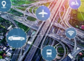
In the hustle and bustle of urban cities, the flow of traffic is both a necessity and a challenge. As cities grow and populations surge, the need for efficient transportation systems becomes more critical than ever.
Explore further into the domain of Traffic Data Analysis, the sophisticated art and science behind understanding, optimizing, and navigating the intricate dynamics of vehicular and pedestrian movements within urban landscapes.
Revealing the Tapestry: Data Collection and Sources
The initial phase of intricate planning involves the gathering of data. Urban planners utilize a variety of sensors, including cameras, radar, and embedded loops in roadways to observe and monitor the urban environment. Additionally, the incorporation of mobile devices and satellite imagery adds layers to the informational tapestry, forming a comprehensive depiction of the dynamics of people and vehicles as they navigate the city.
The Art of Understanding the Flow
Traffic data analysis is a compass that guides urban planners through the intricate paths of traffic flow. By understanding the speed, density, and volume of traffic, analysts identify congestion hotspots and bottlenecks. This knowledge is the key to optimizing traffic signal timings and designing roadways that keep the city moving efficiently.
Shaping Cities with Urban Planning and Traffic Data Analysis
The impact of traffic data analysis extends beyond optimizing traffic lights and mitigating congestion. It plays a pivotal role in shaping the very structure of our cities. The initiation of significant infrastructure projects begins with meticulous planning, where crucial input is derived from traffic data. This underscores the vital importance of accurate traffic data in the planning process. Urban planners rely on these insights to make informed decisions about infrastructure development, road expansions, and improvements to public transportation systems.
Intelligent Transportation Systems (ITS): Where Tech Meets Traffic
Leveraging the power of technology, ITS integrates traffic data analysis into smart traffic lights, dynamic message signs, and adaptive traffic control systems. The result? A city that responds dynamically to the ebb and flow of its inhabitants.
Balancing Act: Traffic Data Analysis and Environmental Impact
Beyond the practicalities of urban mobility, traffic data analysis contributes to the broader conversation on sustainability. By assessing the environmental impact of transportation through lesser congestion and more efficient systems in place, analysts help shape cities that are not only efficient but also environmentally conscious.
How Will Traffic Data Analysis Improve the Traffic Condition on Congested Roads and Highways in India?
Traffic data analysis can play a crucial role in improving traffic conditions on congested roads and
highways in India.

Predictive Modeling:
Advanced analytics can be employed to predict traffic patterns and congestion before they occur. By analyzing historical data, weather conditions, and other relevant factors, authorities can anticipate congestion and take proactive measures to manage traffic more effectively.
Real-time Traffic Monitoring:
Traffic data analysis enables real-time monitoring of traffic conditions. By collecting and analyzing data from various sources, such as GPS devices, traffic cameras, and sensors, authorities can gain insights into the current state of traffic flow.
Dynamic traffic management systems can use real-time data to adjust traffic signal timings, lane configurations, and speed limits to optimize the flow of traffic. This adaptive approach can help alleviate congestion and improve overall traffic conditions.
Optimized Routes & Traffic Signal Timing:
Traffic data analysis can assist in recommending optimal routes for drivers based on current traffic conditions. Navigation apps that incorporate real-time traffic data can help distribute traffic across multiple routes, preventing overloading on specific roads.
Analyzing traffic patterns and historical data can help optimize traffic signal timings. This ensures that traffic signals are synchronized to facilitate smoother traffic flow, reducing unnecessary stops and starts that contribute to congestion.
Public Transport Integration & Sustainable Transportation:
Integrating traffic data with public transport systems allows for better coordination between different modes of transportation. This can help in promoting the use of public transport and reducing the number of private vehicles on the road, in turn moving towards a sustainable approach.
By analyzing traffic data, authorities can identify areas with high pollution levels and congestion. This information can be used to encourage the use of sustainable transportation modes such as cycling, walking, and public transit.
Emergency Response Planning:
Traffic data analysis can aid in identifying and responding to accidents or other incidents quickly. Emergency response teams can use real-time data to reroute traffic and provide assistance more efficiently.
Public Awareness:
Making traffic data available to the public through apps and other platforms can help raise awareness among drivers about current traffic conditions. This can lead to more informed decisions regarding travel routes and times, contributing to a more evenly distributed traffic flow.
In conclusion, in the complexity of urban dynamics, traffic data analysis emerges as a guiding force. It paints a vivid picture of how cities move, breathe, and evolve. As technology continues to advance and our cities grow evermore complex, the art and science of traffic data analysis will remain an indispensable tool for those charting the course of urban development.
Blog by
Sarah Kallianpur
 TrafficInfraTech Magazine Linking People Places & Progress


