Tunnels are growing across India at a rapid pace but planning and execution of these projects is fraught with challenges. An expert panel of different stakeholders raised pressing concerns on the way forward for the industry.
Indian road freight rates are one of the lowest in the world and so are the warehousing rates, yet India has a high logistics cost component as a percentage of GDP. This paradox can only be explained by artificially marked up rail freight cost due to passenger cross subsidisation of passenger fares by railways and an extremely congested network of Indian Railways resulting into tardy and not so reliable multi modal transport solution by Railways resulting into high cost of inventory and resultant high cost of carrying inventory.
According to MoRTH, it is estimated that about 40 km length of tunnels are under operation in India and another 97 km is being implemented. An additional 135 km is under planning stage, which showcases the large potential in the use of tunnels in the country.
But there is a consensus within government bodies and private institutions that the tunnel industry in India has room for improvement, especially in the deployment of technology. There are issues on both sides of the aisle when it comes to planning and the unknown variables that might crop up.
 I.K. Pandey, Director General (RD) & Special Secretary, MoRTH – “We are well aware of the issues related to DPR preparation and we are trying to resolve them contractually. But we want to hear more from the different stakeholders. We have brought AEM technology from Norway but that has a limitation of up to 400 metre depth. We have overburden of 1000 metres; how do we get to that? What kind of geophysical investigations can be done beforehand because boring is not possible at every point? What kind of new technologies can be used; what are the new methodologies?”
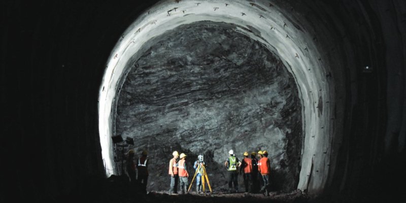
Manpower
Although the industry might be looking at technology to help it move faster, the labour that handles this machinery can have a large impact on the timeline. This can directly affect the costing of the project, often involving fines if there are delays.
An example that was raised at our panel was that of Dump Trucks getting caught in muddy roadways of the tunnel project. An inefficiently planned out drainage system can lead to a delay of a few minutes for each truck, which can snowball into a larger delay of several months for the project.
This can be resolved by staffing awareness, wherein anybody who spots water ponding should be able to report it. This could be included in the technical specifications for the contractor to maintain the roadway. Another point that might be added to the technical requirements is to declare the age of the machinery that is being used and have mandatory machinery maintenance plans.
 Markus Türtscher, Head Tunnelling and Geotechnics Division, Bernard Gruppe & Director, Bernard Consultants – “The best machine, the best equipment available is of no use if it is not exploited to the extent one can. Key success factors are good practice workmanship, deployment and training of personnel, as well as schedule and work sequencing.”
Everyone has to deal with some form of labour issues, with longer shifts leading to reduced productivity. It was noticed by certain private organisations that 12-hour shifts led to more breaks and wastage of time. Keeping shorter shifts, with the same pay-level, led to higher efficiency and low fatigue levels. This was better for throughput of the entire project.
Planning
With tunnels being such immense undertakings, an issue is often raised about rushing the initial planning steps. There are large unknown factors when trying to create a tunnel, sometimes at a depth of a kilometre. Unrealistic schedules within DPRs (Detailed Project Report), that don’t account for geological risks, become a challenge for organisations.
 Eleswarapu Srinivas, Joint GM – Business Development, Heavy Civil Infrastructure IC, Larsen & Toubro – “It is essential that a proper study is conducted, with the uncertainties that are seen. There are challenges in terms of Squeezing, Rock Mass Behaviour, Fault zone / Shear zone, Cavities, Ground Water & Ingress, Special Hazardous gases which can come in, these are all unknown things which are very typical of any underground project. So whatever said, we can only reduce risk by doing a proper detailed project report and geological study in the pre-project phase.”
This can directly affect the costing of a project. Changes seen in the strata might correspond to a similar excavation cost, but it can lead to an increase in support system costs. It is also important to go beyond primary cost contributors like geology and excavation type, with site investigation and procurement strategy being key indicators on reducing cost.
A suggestion that was raised at our expert discussion was to make the Geological Baseline Report as the basis of any contracts, with joint surveys between clients and contractors. Survey Geological Mapping was also suggested as a method to increase the initial familiarity for bidders, with geologists creating maps in the scale of 1:100 in the DPR stage.
Government bodies are collaborating with GSI (Geological Survey of India) as well as DGRE (Defence Geoinformatics Research Establishment) to prepare digital terrain models. DGRE and SASE (Snow & Avalanche Study Establishment) have combined to become one organisation and already have such type of maps, but the scale might need adjustment.
If geologists and geotechnical engineers are given more time, the detailed report that comes out can help decrease costs and reduce timelines. Tenders often require an inception report after four weeks and a final report after eight weeks, which reduces the likelihood of detailed planning.
Contracts
Government bodies have recognised that issues exist in the contracts being used currently and have made changes in their approach. When construction takes place there is bound to be a change in DPR and geotechnical parameters, for which MoRTH has devised contract documents where a fixed classification of Rock Mass and correct length is given. If there is any change, compensation is provided to the contractor with a reference to time and cost.
But concerns exist with the current system. A DPR covers survey, alignment, geotechnical data, land acquisition plans, capital and operational cost estimate, and revenue generation prospects, which might be conducted over a limited period of time leading to issues in the execution phase.
 Vinod Shukla, MD, FGS Engineers & Innovators – “We are still doing conventional monitoring in our tunnels, with the data being taken by manual methods and leading to delays. We should move towards online monitoring and digital monitoring so that the data is real time, like with bridge monitoring systems. Once the data is out of human interference it becomes a scientific case of not having biases toward anybody.”
 Dr. Nishith Gupta, Chief Technical Officer, SYSTRA – “Design and build tenders are prepared in such a way that major risks are passed on to the civil contractor along with punitive clauses of LDs and penalties, and this becomes a major source of delay and dispute. The civil contractor has to price the following risk as it is a design and build contract – inaccuracies in survey and geotechnical data, soil, rock, stuck TBMs, caved in buildings, roads, etc.”
Alternate contracts might be of assistance, which was seen in the delays of the Chennai Metro project. These involve a hybrid contract based around a risk sharing mechanism that is established before the awarding of the contract. The risk is parked with the stakeholder who is best able to manage it. Along with risk sharing, variations can also be accounted for in these contracts. Baseline quantities can be established, and the stakeholders can look at variations in costing accordingly.
There are standard FIDIC documents which clearly explain how the variations, or the contract, should be dealt with in case of an underground project. FIDIC has provisions that give time and cost considerations to the contractor, which can reduce the initial cost of bidding.
 Dr. R. K. Goel, Independent Tunnel Design Consultant & Former Chief Scientist and Professor from Central Institute of Mining and Fuel Research, CSIR – “The main aspect is how prepared you are to tackle any surprises during construction. The variation in geology does not allow you to always extrapolate up to tunnel grade. The personnel involved should be vigilant that problems are likely to be there and therefore they should be ready to face it. They should have material and the expertise available there.
“Time should always be given for investigations, like for the Himalayas if we go for surface mapping – it is vegetated, it may take lot of time and should be backed with geophysical data. With investigations we can prepare the geological map first, then accordingly plan the boreholes, and go for geophysical investigations. Since geophysical is indirect, we can get direct method using borehole and then crosscheck the geophysical.”
Technology
A constant source of complaint is the slow adoption of technology in India for tunnelling. TBM (Tunnel Boring Machine) or digital automated tools might be required to fast track construction and collect digital information on geological formations. Companies are also turning towards automation and Internet of Things (IoT) to increase efficiency, but cost is a major consideration.
Technology can play a major role in treacherous topographies, especially mountainous regions. Airborne investigations can help with surface mapping, which can in turn help with the borehole planning for geophysical investigations. For tunnels with a depth of 1 km, 3D models can be created that help with planning the borehole locations, which can be placed with an inclined orientation instead of vertical. It is also possible for companies to have real time monitoring and probe drilling during construction, using advanced technologies like the TSP (Tunnel Seismic Profiling) technique and MWD (Measure While Drilling) technique to get geological data for a length of at least 200 m ahead.
A point of suggestion from our experts was to create a central data repository that contains all tunnel data. Government bodies are already in the process of implementing this, but it also depends on the type of data that is included such as geotechnical borehole data, 3D terrain profiles, digital land plans, etc.
A centralised platform that brings different stakeholders together could also be beneficial in fast-tracking the approval process and data sharing. Having an integrated database with vital metadata might streamline the entire process and lead to better oversight.
Monitoring is also a concern, as physical monitoring is often conducted by the contractor themselves. Digital systems should be implemented, and the responsibility should be given to companies that specialise in this field. This leads to efficient and real time data that is not taken as a secondary requirement, which should also include geotechnical deformation monitoring.
Utilising educational institutes such as IITs, government bodies might also look at creating technological solutions to help with tunnelling issues. Creating an indigenized industry will help reduce time and cost concerns, while giving a boost to the domestic market. This can counter the large dependence on imported machinery – TBMs, tools, tackles, even anchor belts. This is the next step for the tunnel industry in India.
Some of the suggestions and concerns from our expert panel:
- Formation of a contractual framework that includes specific clauses to deal with unexpected events during construction of the tunnel.
- Need for solutions that provide geotechnical data at large overburdens of 1000m where conventional boring methods are not feasible.
- Need for advanced technology for geotechnical investigation.
- Better management and training of all personnel involved in the project.
- Additional time and resources deployed for geological mapping that can lead to detailed project reports.
- Need for a contractual framework that includes a proper risk sharing mechanism with various stakeholders based on their capabilities to resolve the disputes in minimum time.
- Extensive data related to survey, existing buildings, utilities, geotechnical data needs to be available in a centralised repository and this needs to be updated in real time.
- Using platforms like the Pradhan Mantri Gati Shakti to minimise the co-ordination and approval time with various authorities.
- Need to reduce risk through proper detailed project report and geological study in the pre-project phase, so that there is sufficient site data and bankable DPR available to the contractors before tendering.
- Need for a shift from the conventional item rate contract to help contractors deal with the uncertainties and associated variations in a better way.
- Joint survey by both the client and contractors for uncharted terrains.
- Focus on indigenization of most items that currently rely on imports, and a standardisation in the bid conditions to have new equipment mandated.
- Fixing of timelines to take care of cost overruns and time overruns.
- Provide time and money for fore-probing in terms of TSP or drilling.
- Creation of separate specialised contracts for monitoring.