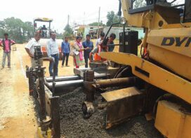
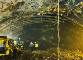
Feasibility study of new alignments and widening of existing Roads
• High resolution Satellite data obtained from satellite/UAVs will be useful in providing inputs for preparing DPRs.
• It is possible to provide current land use situation in the identified stretches taken up for new road alignments / existing roads for widening.
• Facilitate over lay of the cadastral / revenue maps along the RoW and the specified corridors for identifying the survey numbers / ownership of land parcels useful for notification and R&R activities.
• Multi Resolution Earth Observation (EO) data will be the primary source of information in creating Spatial thematic data base, on different scales, useful in various stages of Road construction activity like Reconnaissance Stage, Feasibility Stage, Design Stage to Execution Stage.
• Assists in identifying possible corridors for road alignment/ development.
• Provides basic inputs on natural resources like land use, terrain, drainage, forest areas, environmentally fragile area,structural aspects, Heritage sites etc. required for preparing EIA report
• Assessment of availability of raw materials required in road construction activity within the proximity of project area.
Preparation of Detailed Project Report using LiDAR / Drone
• NHAI had envisaged the use of Information Technology and Information Technology enables services for the preparation of DPR. Currently DPR is prepared which is near to accurate in terms of field specifications as DPR is prepared using data supplied by one of the latest technologies in the area of 3D sensing i.e. Light Detection and Ranging
• Light Detection and Ranging (LIDAR) is a remote sensing method used to examine the surface of the Earth.
Project Monitoring Information System
• NHAI has developed its own Project Monitoring System (PMIS) for effective and online tracking of development of National Highways.
• PMIS is a state-of-the-art, real time project tracking and monitoring system deployed across the entire NHAI organization.
• The system is currently being used by officers at HQ, RO and PIUs to conduct daily monitoring of over 400 active projects.
• Using this system, the obligations of the Authority and Concessionaire are effectively and timely met.
• PMIS has a comprehensive database with over 180 data fields for each project and a further 500 fields specifically for complex PPP projects, covering all key progress metrics
• A series of Executive Dashboards have been designed to provide updated progress on these data fields, at various levels, such as national, RO level, PIU level & project level. An in-built algorithm automatically highlights focus projects with key pending issues.
• PMIS is linked with GIS mapping of National Highways along with Mobile App.
Road Asset Management
 • For effective and efficient road asset management, a comprehensive data base on the road assets is essential, which should be scalable and easy to populate with required inputs on the roads, features along the RoW such as bridges and culverts. Depending on the type and dimensions of the features / objects, initial data base can be generated using multiple sources like
• GPS enabled Smartphone based location based services, which are deployable parallel at many locations, quick and enables collection of data on the fly and they can also be used as crowd sourcing devices
• Inventory of asset is also feasible through high resolution data from Satellite/ aerial/ UAV platforms. (Based on National data policy)
• RAMS developed will be used for planning and budgeting for maintenance of highways.
Road Safety
• NHAI has launched pilot project in two states UP & Rajasthan to develop world class integrated Traffic Incident Management System (TIMS) with the development of integrated Regional Centres for surveillance and monitoring of Incidents on the National Highways.
• GPS enabled Rescue Ambulances to be deployed at every 30-40Km so that it can reach to the place of accidents within 15-20 minutes.
• GPS enabled Surveillance vehicles, recovery cranes to be deployed at every 40Km.
• Providing of Wi-fi zones on the highways
• Lighting by using solar panels on the highways
• Interactive sign boards on the highways
• Provide Way side amenities at regular intervals to break monotony and avoid accidents.
• Involving NGOs in handling of Road Safety issues and create awareness among the highway users.
Road Network Maps
• NHAI is digitalizing the maps of all National Highways across India • These maps will be interactive in nature and will display information of Road network, Tolls, Road features, coverage area, etc.
• Maps will be zoomed in/out to view GIS layers.
Implementation of Online Monitoring System of National Highways Network:
• NHAI is in process of implementing online monitoring of National Highways • network using IP based smart camera with ANPR.
• This system will have sharing of activities in real time such as data sharing/live video-streaming/ video conferencing by connecting all 24 RO, 168 PIU and around 425 Toll- Plazas across India
• Online Monitoring of Project Execution through connected NHAI HQ and Regional offices/ Project Implementation Units.
• Online monitoring of Operation & Maintenance of Roads.
Electronic Toll Collection – FASTag
 • NHAI has introduced Electronic Toll Collection on National Highways in India using passive Radio-Frequency Identification (RFID).
• FASTag is a reloadable tag which enables automatic deduction of toll charges and lets vehicles pass through the toll plaza without stopping for the cash transaction.
• Tolls are in process of modernization using key ITES solutions such as smart surveillance IP based camera with ANPR, video conferencing facility at the tolls connected through related RO, PIU and NHAI HQ
• FASTag has been fixed on more than one million vehicles in less than six months.
• This is a mammoth task considering the geographical reach and socioeconomic- political conditions of the country.
• Operationalized one fully ETC lane on 388 Toll Plazas of India.
• The toll collection through ETC has reached to Rs 450Cr per month amounting to 21% penetration of total Toll collection.
• Converting more than 4200 tolling lanes on 421 Toll Plazas spread across the country in Hybrid ETC enabled lanes.
• The Hybrid ETC technology is an innovative concept of ETC tailored for Indian conditions to cater for space crunch at Toll Plazas.
• NHAI is working towards the ultimate vision to convert Tolling on Highways into hassle free distancebased tolling without any Toll Plaza infrastructure.
 TrafficInfraTech Magazine Linking People Places & Progress


