
Traffic data is extensively used to analyse travel patterns, destinations, and journey durations. Backed by real-time information and rich insights, data analytics helps identify underutilised routes, increase safety on the roads, bolster emergency rescue services, improve resource management, create sustainable transportation solutions, and refine urban planning strategies.
The latest data from the Ministry of Road Transport and Highways reveals a concerning scenario in India’s transport sector. In 2022, road accidents tragically claimed 19 lives every hour, highlighting a critical need for transformative measures. In response, stakeholders nationwide are mobilising to enact changes that could significantly enhance the safety and well-being of Indian citizens. A notable initiative by the Central Government is to eliminate 9,000 accident-prone zones on National Highways by 2025.
This ambitious goal, however, hinges on the availability and effective utilisation of data. In this era of data and analytics, we are witnessing an unprecedented capacity for informed and constructive policymaking. As our understanding of data deepens, so does the potential use of it to foster safer, more efficient transport systems. The evolving landscape of data analytics is not just reshaping our approach to addressing current challenges but is also opening new avenues for proactive and preventive strategies in road safety.
Very increasingly data is used by the authorities and the transport bus operators for finding the commuting pattern of the citizens: how many are taking public transport, how many go by shared transport, how many go by two wheelers, walking, private cars, etc. Not only for traffic management at the signals, how data is used for planning transport operations within the city.Yogesh Wani, FLIR ITS

The Role of Data
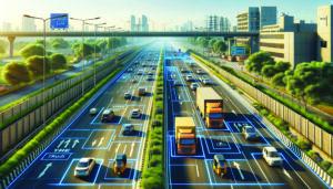
In the realm of urban mobility, the deployment of advanced data collection systems is pivotal. These systems harness data from diverse sources, including GPS tracking in vehicles, mobile and stationary sensors, telecom network analytics, video surveillance, radar/lidar technologies, and an array of Internet of Things (IoT) devices. For instance, geospatial data collection methods offer profound insights into vehicle and pedestrian traffic patterns – travel speed, traffic volumes, traffic flow, geographical data, vehicle data and even queue lengths.
Urban planners are increasingly relying on Intelligent Traffic Management Systems (ITMS) to synthesise this data. These systems are monitoring tools that act as comprehensive platforms for data aggregation, analysis, and visualisation. A case in point is Vaaan Infra’s ITMS, which combines real-time data from various sensors, cameras, and IoT-equipped devices. This integration facilitates optimised signal timings, congestion management, and enhances the overall vehicular flow on roads.
The efficacy of these tools lies in their ability to perform critical functions such as real-time monitoring, seamless integration of disparate data sources (including weather stations, traffic sensors, GPS, and incident reports), and sophisticated traffic analytics using artificial intelligence and machine learning. These systems should be scalable, secure, and compliant with the evolving demands of smart city infrastructures and expanding urban landscapes.
According to Yogesh Wani, who represents Security / ITS business of Teledyne Flir in India, “Data can really help in different ways, not only to control the traffic but also to help in the planning of future roads. By learning from current roads, planners can determine the best way to develop new junctions or maybe even new cities. They would know, for example, that in a particular city, 40 percent of the traffic is comprised of buses, and those buses create traffic jams. So it may be, by collecting data here, planners can implement what they learn in the development of new areas.”