Digital maps are valued as the third most important service of the internet, behind search and email, as found in a 2019 study conducted by MIT. While cartography has been around for millennia as a way to understand the places we inhabit, digital mapping is an innovation that leverages the technology of today’s digital age. GPS, cars with holographic maps and other innovations see that one never gets lost anymore while travelling. Sid Jalan examines the way mapping and navigation services are changing the mobility patterns around the world.

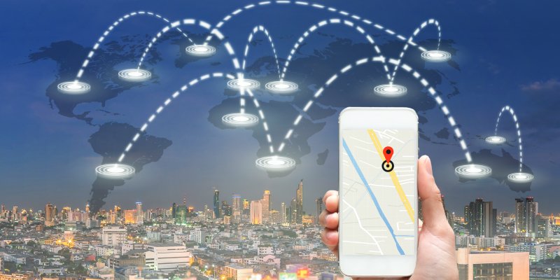
Digital mapping is simply digital cartography, where spatial and geographical data is collected, compiled and analysed to generate a digital map. The primary aim of digital mapping is to produce virtual maps that provide accurate information beyond pure geography and include various layers of data.
Traditional maps, born from cartography, were pivotal in helping us understand nature, explore the globe, and develop international trade. Digital maps offer greater accuracy as compared to these, which are scalable to different use-cases beyond navigation.
Tabrez Alam, Founder, Intents Mobi says, “For individuals, I would say the efficiency brought about in our day to day lives by better routing will rank fairly high. Navigating to a new place and being able to get our e-commerce order the same evening, both rely on this. If we talk about businesses, there are whole industries, like food-tech or ride hailing, that would not have been this big without the developments we have seen in the mapping space over the past decade or so. Even for smaller businesses, digital maps allowed a better digital footprint enabling discovery and reach to newer customers.”
Digital maps can offer data that was not available before, such as population density, fertility rates, density of doctors, time taken by people to reach hospitals, employment rates, living conditions, environmental risk factors, agricultural yield change, etc. This enhanced functionality is key in the digital map market that is projected to reach USD 55.2 Billion by 2031, according to Straits Research.
Companies like MapMyIndia are trying to leverage various mapping needs to provide a whole range of solutions for individuals, enterprises and governments. They have partnered with the Indian Space Research Organisation (ISRO) to leverage ISRO satellites for 3D mapping of the Indian subcontinent, building digital map data, telematics services, location-based SaaS and integrating it with technology for automobiles.

An area of innovation is the use of augmented reality (AR) and virtual reality (VR) technologies to create immersive mapping experiences.
–Abhiram Athavale
Technology involved with digital mapping
Geographical Interface Systems (GIS) form the basis of digital mapping, which consists of hardware and software that can store data in the form of raster or vector. These have their own use-cases in data capture.
This geospatial data can be captured by:
- Satellite imaging
- Aerial photography and photogrammetry
- Differential Global Positioning Systems (DGPS)
- Electronic Total System (ETS) for land issues
- Remote sensing through Interferometric Synthetic Aperture Radar (InSAR)
- Scanners and sensors
Drones are becoming popular for digital mapping with costs not being as prohibitive as satellites. Deployment can occur over smaller areas for specific reasons – Event mapping, small town mapping, and even surveying natural disasters. Drones are also being used for internal facility mapping, which allows a business to plan their structures and product movement.
Google, one of the foremost players in the digital mapping space, uses a combination of GIS data, satellite imagery, aerial photography, street maps, and 360o street views, to provide updated mapping data for route planning. Their cloud-based geospatial analytics can be highly beneficial for businesses to understand the efficacy of their location.
Companies like ESRI provide software to visualise and understand your data spatially. Leveraging dynamic and interactive mapping, organisations can determine patterns and gain additional perspectives through personalised maps.
Smart Cities and Civic planning
The entire intention of smart cities is to create efficiency in its internal planning through digital solutions, which run through centralised systems. It includes urban mobility, sustainable built environment, integrated infrastructure and transport, energy efficiency, with information and communication technologies.
India is trying to create a digital twin of each smart city, which is the first step in the direction of better management, adds Alam. “As we are calling these cities ‘smart’, their management also needs to be smart. Right from the fact that digital mapping can enable town planners to create efficient public transport routes and even determine what should be the wait time at a traffic signal. The potential is immense, and we believe that digital mapping would be the key in making our cities actually smarter.”
According to the UN 66% of the global population will be living in cities by 2050. Digital mapping is key in unlocking this.
- Daily commutes and last mile connectivity
- Increased safety through crime mapping and faster deployment
- Pollution maps to reduce emissions impact on the environment
- Enhance social interactions through urban planning
- Efficient logistics movement through transportation systems
- Identify at risk demographics and improve access to healthcare
- Boost business outcomes through smart infrastructure mapping

Gaps remain in mapping solutions because mobility in India has its own unique challenges. Even across geographies inside the country, the challenges vary with the terrain, demographics, local climate and expectations of users or businesses. And this is why localisation is very important. To make sure even the last bit of inefficiencies are eliminated and to make location intelligence truly accessible to everyone.
–Tabrez Alam
Munish Malhotra, Partner & Alliances Manager at HERE Technologies states, “In our country, we have segregated data sources which can become problematic for planners. Sewage plans, electrical lines are not always properly planned. For the first layer of smart cities, we need enriched map data which can be used by line departments – gas, electric, water. They should all have access to cohesive data, so as to minimise outages and problems. Intelligence also needs to be built into traffic lights with sensors, which can determine flow of traffic based on the type of traffic.”
What are the challenges for digital mapping in India?
Data can be the boon or bane of digital mapping, as selective access to data can prevent the ideal use of maps. Digital mapping involves large volumes of data with a need for low latency, which can become a barrier to entry for many companies.
Malhotra feels that the more data we have, the more analytics we can do. However that is not enough, as we also need to add unique forms of data like socio-economic factors. A major concern is global mapping software not being able to account for the demographic nuances and local requirements of the Indian subcontinent.
Alam states, “Many of the mapping solutions that exist evolved in the West and are not able to cater to the unique requirements that our market has. To top that up, most of the business facing tools offered by them are an extension of the consumer products, leaving gaps that force businesses here to find their own alternate solutions. However, as the market and regulations are evolving, these challenges create opportunities for companies like ours to make products that cater to the unique needs of Indian users and businesses.”
According to Munish Malhotra, address standardisation is also a problem across the country – “When working in a mapping environment, you need a structured environment. So if you want something you will get the exact hit, where based on the house number, building and pin code you can reach the exact location. In India, we lack this standardisation, where the address can run into multiple lines. If the search engine fails, routing becomes problematic. If a society has three gates, the mapping software can take you to the wrong gate thereby increasing lead times.”

When it comes to business expansion and mapping, if banks were to give loans, they want to check if there are any risks based on locations. This could be a potential future application, where based on your driving, your premiums could change. City driving could have higher premiums compared to rural.
–Munish Malhotra
Localisation and Data
Data storage is an important aspect of digital mapping, as servers can become prohibitively expensive for many companies. Cloud computing is offering some respite, with deployment for edge computing showing potential. However, data localisation is another question that arises with governments requiring sensitive geographical and economic information staying within country borders.
Abhiram Athavale, Head – Partner Relations, 21North Europ Assistance says, “Digital mapping in India has been a topic of concern in terms of privacy and security due to the sensitive nature of the data involved. Digital maps can contain information on individuals’ locations, addresses, and other personal details, which could be misused by malicious actors.
“Additionally, maps may contain information about critical infrastructure, sensitive government locations, and other strategic sites, which could pose a security threat if accessed by unauthorised individuals. The Indian government has issued guidelines on digital mapping in 2021 to address these concerns, which aim to regulate the collection, storage, and dissemination of mapping data. This is an important step towards addressing privacy and security concerns, but further discussion and refinement may be necessary to ensure that they are effective and practical in practice.”
Adds Alam, “ We take privacy very seriously and therefore, we do not gather any information that we deem as not necessary. For example, when you use Intents Go app for navigation, the app does not communicate with our servers for the first 1000 metres of your movement. Even if someone was to get access to the location data, the individual user can’t be pinpointed because our data would show a circle with a radius of 1000 metres. In a country like India, 1000s of people would be living in that circle. Similarly, when we gather points of interest through our street view and images collected by our gig economy workers; in case the image contains a face, it gets blurred at the edge itself. Hence, the image that we get at the central server is already a blurred face.”
Different use-cases for digital mapping
Most people look at logistics and human mobility as the larger use-case for digital mapping. However it has shown to be an effective tool in disaster response for various governments. Interactive maps, which leverage predictive technology, can identify areas that are flood prone and geologically active, allowing for better planning by disaster relief organisations.
The future – AI, AR and VR
Artificial Intelligence (AI) and Machine Learning (ML) are deemed to play a large role in the future of digital mapping. AI algorithms can process and analyse large amounts of data which can help create more detailed and accurate maps. It can ingest real-time data that can be utilised for route planning and optimisation. These are already being used by logistics providers to reduce their fuel consumption, optimise delivery schedules and mitigate their environmental impact.
In rural areas, which have not been effectively mapped out, AI-based data capture can reduce human intervention and provide significant data for infrastructure and land use. Projection modelling can even help governments and businesses determine agricultural yields for export.
On innovations, Athavale says, “An area of innovation is the use of augmented reality (AR) and virtual reality (VR) technologies to create immersive mapping experiences. This could be particularly useful in urban planning and architecture, allowing planners and designers to visualise and test new developments in a virtual environment before they are constructed. We can expect to see continued innovation in the use of mapping for transportation and logistics.”
With integration of IoT devices and sensors, larger amounts of data will be available to companies – Insurance providers have already started testing out the use of this data for claim fulfilment. If a driver was over the speed limit, the insurance companies have a reason to not fulfil the claim. This could have an indirect effect on road safety, showcasing the larger benefits of digital mapping on our society.
Alam believes that what we are seeing currently is only the beginning of a revolution, probably bigger than the invention of the first digital maps. Some of the recent developments have brought attention to AI across many industries. “ In this space, one of the ways we have been using AI is to accelerate the process of creating and more importantly, updating map layers, which until now has been a painfully slow process. It has condensed many years’ worth of progress into weeks for us while also improving the accuracy. We are heading towards the next era of map making where maps will closely mirror the real world.
“Another area of innovation to engage with would be the connected vehicles with different levels of autonomous capabilities. They will not only require new layers of map data that has not existed until now, but would also be contributing towards it further accelerating the evolution of maps. Of course, improved connectivity is central to all these developments but with 5G networks rolling out already, I think we do not have to worry there.”