 The Department of Civil Engineering at IIT Bombay hosted an International Workshop on Adaptive and Connected Signal Control Systems for Urban Traffic Management in January, 2025. Sponsored under the IoE scheme, the workshop highlighted current capabilities, challenges and opportunities in adaptive and connected traffic signal control, including field deployment experiences. Presentations covered leading international ATCS systems (SCOOT, SCATS, EcoTraffiX), Indian systems (CoSiCoSt, FAST), and academic insights from IIT Bombay and Imperial College London. This article by Rajesh Krishnan, CEO, ITS Planners & Engineers Private Limited summarises the highlights.
A comprehensive traffic improvement plan, including road condition improvement and enforcement, needs to go hand-in-hand with ATCS systems in India to realise their full potential.
SCATS, first implemented in Sydney in 1974, is the world’s oldest area traffic control system. It holds approximately 50% of the international ATCS market share and is regarded as one of the leading systems globally, alongside SCOOT. SCATS has traditionally used data from stop-line detectors on every lane at junctions. The detector data is used by a heuristics based algorithm that tries to optimize the Degree of Saturation (DoS). The algorithm is distributed between the central ATCS server and the local traffic signal controller. The centralised optimisation algorithm determines the cycle time and the coordination between junctions, while the splits are determined locally at the traffic signal controller.
The system stores the data centrally. Historic data are combined with live data to provide insights and analytics to traffic managers. SCATS system is constantly evolving to serve the changing user needs and to leverage emerging technologies. The system is currently being upgraded to consider more modes of transport such as freight vehicles, commercial vehicles, public transport and cyclists, rather than just private vehicles.
The system have had the ability to make use of pedestrian presence data recorded by push buttons – the system is being enhanced to make use of data from a variety of detector types such as LiDAR, radars, CCTV and infrared sensors.
The technology platform of SCATS is also getting updates to make use of a modern technology stack, along with an improved Graphical User Interface (GUI). One of the GUI improvements is to make it more intuitive and therefore reduce the amount of training required for new control center operators. The new GUI will also enable a network view of the city with data insights. The new platform will also provide a modern API for third-party application providers who wishes to integrate their systems with SCATS.
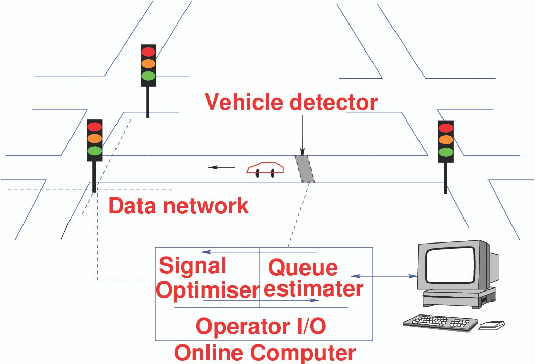
SCOOT is as well-known and widely used as SCATS. It had its origins at the Transport Roads Research Laboratory (TRRL) in the UK in 1973. It was first deployed on the field in Glasgow in 1976, followed by deployments in Coventry and Maidstone in 1979 and 1980 respectively. SCOOT uses a model based optimiser that uses data from upstream detectors, typically installed 100m from the stop-line. SCOOT can use per-lane detectors or cross-lane detectors spanning two lanes, even though the latter is becoming increasingly rarer.
The basic SCOOT algorithm optimises signal timings consisting of split, cycle-time and offset for a group of signals in a SCOOT region, with an objective of reducing a weighted combination of delay and the number of stops. SCOOT, unsurprisingly, has evolved continuously since its inception. Since the implementation of the basic adaptive signing timing optimisation algorithm in the 1980s, SCOOT added public transport priority in the 1990s. Its models were improved in the 2000s and emissions were added in 2010s. Inclusion of non-motorised travel (active travel) modes such as walking and cycling were added to the optimisation in 2014.
SCOOT was an optimisation algorithm – not a fully fledged ATCS system capable of communication with traffic signal controllers. The commonly used ITS architecture in the UK uses an Urban Traffic Control (UTC) system that is responsible for communication with signal controllers and for hosting and communicating with the SCOOT algorithm. TRL developed their own UTC in 2017 making SCOOT a fully-fledged ATCS system. The developments continue in 2020s making use of advances in computer science such as Big Data, Open Data, Artificial Intelligence (AI) and automation.
SCOOT is undergoing several algorithmic and methodological enhancements.
The Split Multiple Optimisers (SMOP) approach tests multiple candidate signal timings and selects the most effective, delivering an additional 3-11% on-street improvement over the existing optimiser. SCOOT optimiser already boasts a strong track record, reducing delays by 5-40% compared to fixed-time or earlier adaptive systems in various cities worldwide.

Future SCOOT systems will dynamically select from a range of optimisers based on factors such as traffic state, flow levels, trends, or objectives (e.g., local vs. global benefits). The new SCOOT-8 system will also be able to make use of crowd-sourced data and data from external APIs and Waze for Cities, will have incident detection functionality and will have automatic traffic signal performance measures. The system will also be able to predict the network state 60 minutes into the future. Lastly, the latest SCOOT will be able to dynamically identify and recommend regions (consisting of a group of junctions), a functionality that is already available in SCATS.
These advancements will also minimise calibration and revalidation efforts required by users. In older SCOOT versions, SCOOT parameters require regular field validation; for instance, Transport for London revalidates SCOOT models at all junctions at least once every three years, and annually at key junctions.
Additionally, tasks can be automated using a rule engine, further minimising the manual effort needed to operate the system.
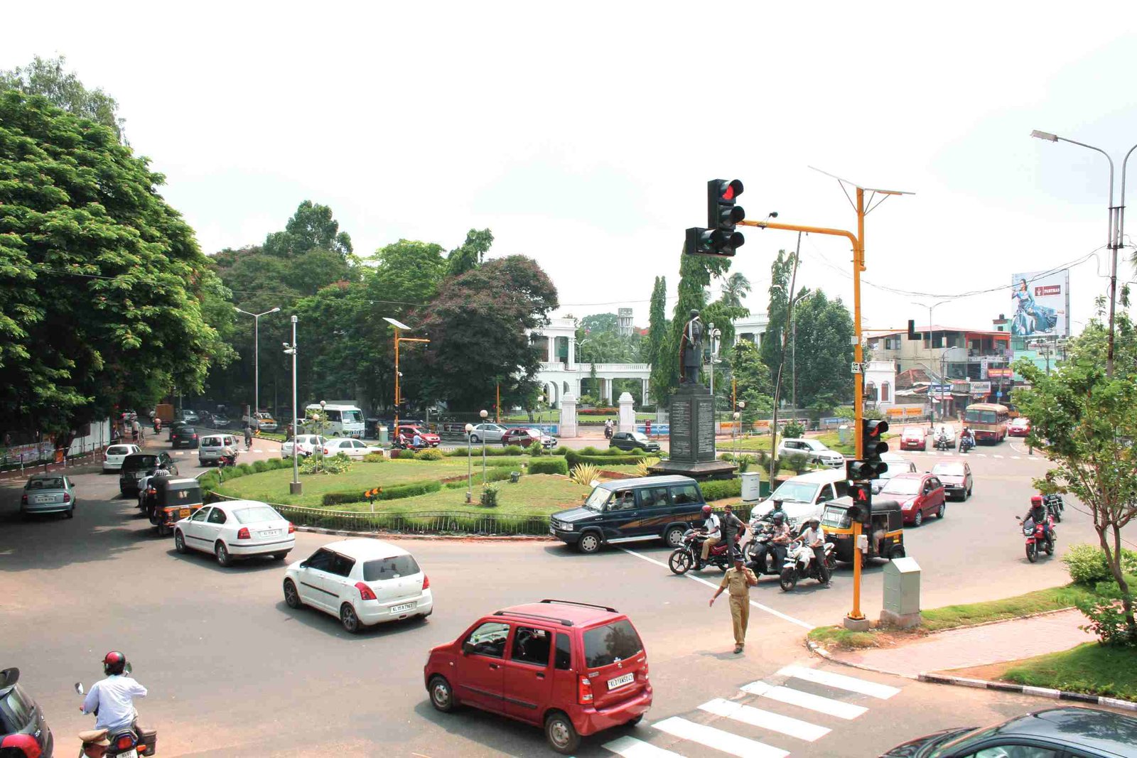
SCOOT and SCATS have predominantly been deployed in the developed world where the traffic is homogenous and lane disciplined driving is the norm.
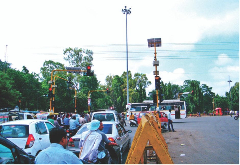
EcoTraffiX from Kapsch deployed in Mumbai has shown improvements in journey times ranging from 4%-11% making use of data from video based detection technology. IBI/Arcadis has shown 65% reduction in congestion (km/day) on a corridor in Bangalore by adopting such a holistic approach in conjunction with the CoSiCoSt system from CDAC.
CoSiCoSt (Composite Signal Control Strategy) is an Indian ATCS system developed by the Centre for Development of Advanced Computing (CDAC). It uses a distributed heuristic algorithm. The centralised algorithm manages the cycle time so as to keep the DoS within 90%, suggests stage durations and offsets. The local component of the algorithm fine tunes the stage durations during runtime based on real-time demand. The system also implements logical quits for junctions that cannot run the common cycle time within the desired DoS.
CoSiCoSt is impressive as it can achieve reductions in delay using presence based detection under Indian traffic conditions using its innovative approach. CoSiCoSt is also evolving and can provide advanced functions such as incident detection and management. It supports a number of information dissemination mechanisms such as Variable Message Signs (VMS), mobile apps, dynamic speed displays, Public Address (PA) systems and social media, and can provide information about roadworks, weather and air quality in addition to travel and congestion related information.
Flexible Adaptive Signal Timing (FAST) is one of the newest ATCS systems from ITS Planners & Engineers (ITSPE). FAST is an algorithm that runs on top of a traffic management platform called the Traffic Intelligence Server (TIS) that is responsible for communication with traffic signal controllers, along with providing the GUI and a number of supporting functions.
FAST is a model based optimisation algorithm that also uses heuristic logic to determine signal timings. FAST makes its decisions based on an online model or a digital twin that is calibrated using live data.
FAST can make use of data from a variety of detector types including legacy detectors providing presence (0/1) data, modern detectors providing Vehicle-by-Vehicle data such as video based detectors and tracking data such as radars, and make use of vehicle counts or PCU values. The system can also use data from external sources available through APIs for travel time and Origin-Destination (OD) information. The algorithm uses the online model to make signal timing decisions using a heuristic mode that makes of DoS metrics, an optimisation mode that minimises delays.
The system also supports a model-less and detector-less mode solely making use of travel time data from crowd-sourced APIs. The algorithm has shown to have reduced travel times in the range of 4-10% in the field compared to fixed time or VA.
Sustainable cities and communities, climate action, and good health and well being are three key UN Sustainable Development Goals (SDGs), with transport playing a critical role in each. It is essential for the ITS industry to leverage technology to enhance urban traffic efficiency and support these global objectives. Major ATCS providers, both established and emerging, are continually improving their systems, fostering healthy competition that will ultimately benefit the global community. Focused technical workshops where leading international ATCS experts congregate are indeed rare.